Driving Resilience and Sustainability with Precision Data
The Sustainability and Resilience sector is crucial for fostering development that meets present needs without compromising the ability of future generations to thrive. Digital E Consulting leverages advanced Unmanned Aircraft Systems (UAS) and sophisticated data analytics to provide high-resolution aerial data and comprehensive geospatial services. Our solutions are designed to support sustainable urban planning, disaster risk reduction, and climate resilience, making us a trusted partner for clients committed to creating sustainable and resilient communities.

Sustainable urban development requires detailed and accurate geospatial data to plan infrastructure that minimizes environmental impact while maximizing efficiency. Our geospatial services support urban planners and developers in designing green buildings, optimizing land use, and creating resilient infrastructure. By providing precise data, we help facilitate the creation of communities that are environmentally responsible and socially inclusive.
Our sustainable urban planning services include:
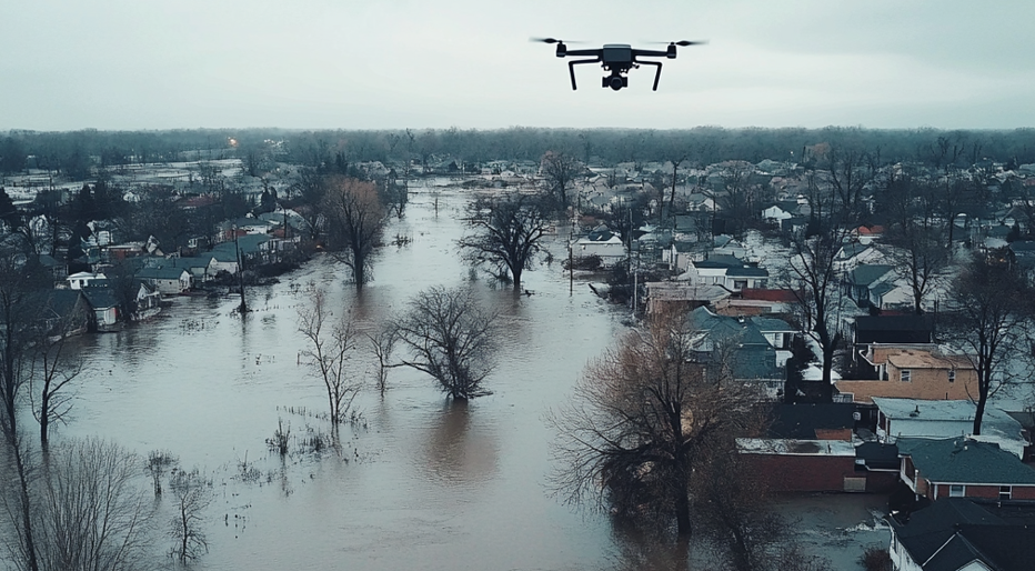
Preparing for and mitigating the impact of natural disasters is a critical aspect of building resilient communities. Our advanced geospatial solutions provide the necessary data to assess risks, plan effective responses, and manage disaster recovery efforts. By offering detailed risk assessments and real-time monitoring, we help organizations and communities reduce vulnerability to natural hazards and enhance their capacity to recover.
Our disaster risk reduction and management services include:

Building resilience against the impacts of climate change requires comprehensive data and forward-thinking strategies. Our geospatial services offer insights into climate vulnerabilities and help develop adaptation strategies. From coastal erosion monitoring to assessing the impacts of rising sea levels, our solutions support clients in making informed decisions that enhance the long-term resilience of their communities and ecosystems.
Our climate resilience services include:
Promote sustainable urban environments with advanced geospatial solutions for tree monitoring and management. Our drone-powered and GIS-integrated services provide precise data to support urban forestry initiatives, enhance green infrastructure, and improve environmental quality.
Our urban tree monitoring services include:
Benefit from high-resolution topographic models for more accurate simulations
Estimate risk and vulnerability using simulation software
Up-to-date building and asset inventory powered by drone aerial data