Innovative Geospatial Solutions for Infrastructure Development
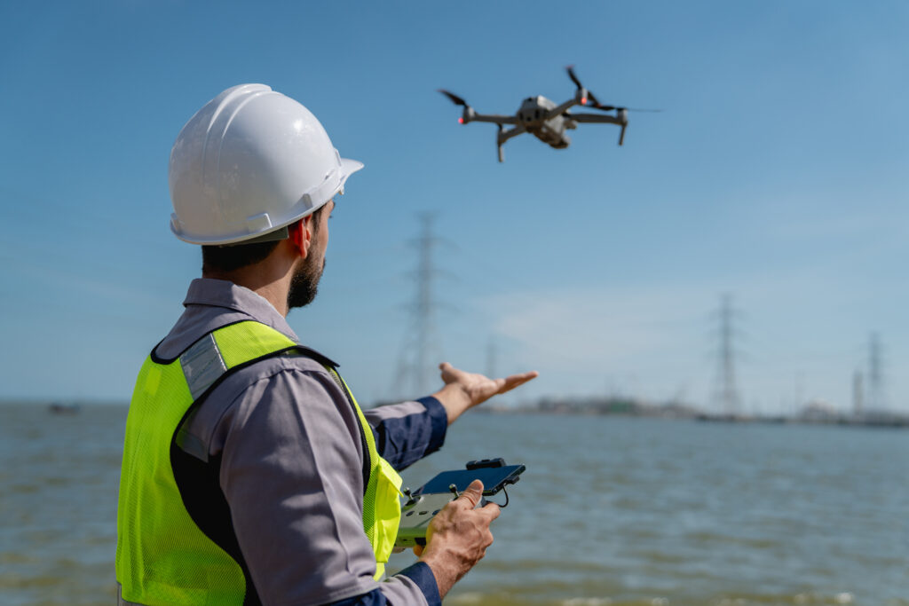
The Civil Engineering and Transportation industry is vital for developing and maintaining the infrastructure that supports our modern society. Digital E Consulting specializes in providing high-resolution aerial data and comprehensive geospatial services using advanced Unmanned Aircraft Systems (UAS) and state-of-the-art data analytics. Our detailed geospatial solutions assist civil engineering and transportation clients by offering accurate site assessments, digital twin creation, and infrastructure inspections. These insights support the design and maintenance of roads, bridges, and other critical infrastructure, helping to optimize construction schedules, improve safety standards, and ensure long-term project sustainability.
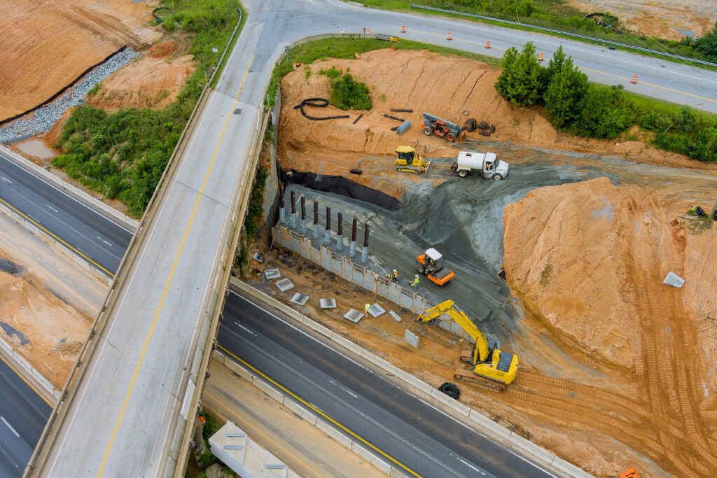
Accurate data is critical for designing and developing infrastructure projects. Our aerial surveying and mapping services provide detailed spatial data that supports the creation of precise plans and models for roads, bridges, and other civil structures. This data helps engineers make informed decisions, optimize designs, and improve project outcomes.
Our infrastructure design and development services include:
Effective transportation planning requires comprehensive data on existing conditions and future needs. Our geospatial services provide transportation planners with the information they need to design efficient, safe, and sustainable transportation systems. This includes analysis of traffic patterns, road conditions, and environmental impacts.
Our transportation planning and analysis services include:

Safety and maintenance are critical components of Civil Engineering and Transportation projects. Our advanced aerial inspections and Non-Destructive Testing (NDT) techniques help identify potential issues and understand the structural integrity of infrastructure. This proactive approach reduces risks during inspections and produces reliable and auditable high-resolution data.
Our safety and maintenance inspection services include:
Empower your engineering projects with advanced GIS and drone-driven solutions. From detailed mapping to precise 3D models, our services deliver the actionable insights needed for efficient design, analysis, and maintenance.
How we support engineering firms:
Digital representations of physical assets
Automated scans of physical assets using drones with high-resolution cameras
Detecting Issues Beyond the Visible Spectrum
Your Partner in Geospatial Solutions
Stay informed with the latest insights—subscribe to our newsletter today!